


Plan de collecte de données MEDISS: directives sur l'utilisation de "QGIS"
Contenu disponible uniquement en anglais.
As we describe in Integrating data on ecosystems, communities, and water resources: insights from the UN Sustainable Development Agenda, the MEDISS Data Collection Plan (DCP) is a strategic tool of the project. Information sharing is a necessary step when contingency strategies and deviations occur.
Moreover the elaboration of up-scaling proposal and the final technical report are helped by the MEDISS data collection tool.
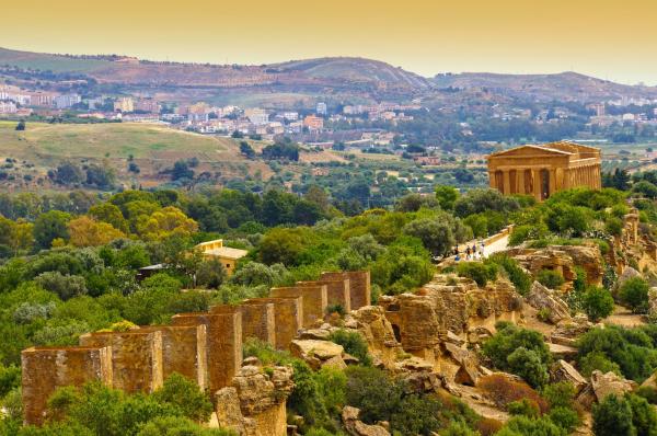
The Italian partner Ente Acque della Sardegna (ENAS) has defined specific Guidelines for the Data Collection Plan that design a model of database collection process and a Geographical Information System (GIS) for the 4 pilot areas (Italy, Palestine, Jordan and Tunisia).
The main goal of the of database collection process is to collect and supply information to frame the knowledge on the 4 pilot areas of MEDISS project, concerning environment, landscape, settlements and socioeconomic characteristics. The MEDISS database is the most important tool to support the collection and validation of data and to provide milestones to set the monitoring plans for each area.
The DCP was elaborated evaluating local beneficiaries and target groups as well as data needs for the MEDISS database.
Ente Acque della Sardegna ENAS coordinates the activities of the MEDISS Board of Expert for the work package 3 Analysis and Monitoring and supervises the monitoring and evaluation activities of the pilot plants, upgrading the database and providing feedbacks (including strategy/contingency plans if necessary).
The DCP and the GIS are the core of the database that must be implemented alongside the project life with the results of the monitoring activities on pilot sites.
The preliminary data collection was organized in sections where each partner indicates the main characteristics of pilot area. Descriptive and detailed information on existing data are requested, as well as georeferenced data, reference literature etc.
The complexity of information requested during the data collection process phase as well as during the monitoring plans setting up, needs an Information Technology resource that overcomes the simple restitution in hard-copy form.
In this contest, the Guidelines help to reach the same goal in the 4 MEDISS areas: each partner is invited to proceed with the collection of data and to feed their specific database that will be merged in a unique MEDISS database.
To enhance the data collection process, Ente Acque della Sardegna ENAS has opted for an open-source software (QGIS available here https://www.qgis.org/en/site/).
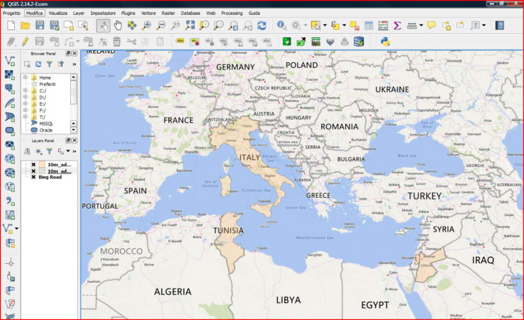
Figure 1: Example of elaboration with the client QGIS
Each partner provides their data for the GIS Client, according to the Guidelines instructions and video tutorials prepared by ENAS. For the collection and elaborations of data, ENAS provides an FTP service for data sharing.
The geographic dataset is the starting point for data analysis and for identifying landscape, environmental, settlements and socioeconomic values on a local scale, furthermore supporting the monitoring plan setting up.
The dataset cannot be considered as a simple “container” of information: it is a set of elements of a geographic database useful to study, with an in integrated approach, the environmental values, the conservation measures but also the relationships and interference with the other landscape elements with the aim of setting up an open knowledge system, continuously deployed. A dynamic tool for the monitoring of the project milestones and the “values of transformations” into the pilot areas.
The dataset contains all the information for the basic and thematic cartography editing that frame the basic knowledge related to the territories (at administrative division level) and set for the print in 1:25.0000 - 1:10000 scale. Moreover, into the dataset must be stored also the information for the detailed cartography at 1:5000 and 1:2000 scales.
Further detailed information can be extracted for different fields of research in each pilot areas, thus ensuring the knowledge capitalisation process.
Basic and topic maps output
- Frame maps
- Geologic maps
- Hydrogeological maps
- Land unit maps
- Soil permeability and watershed maps
- DTM (Digital Terrain Model)
- Slope maps
- Landscape, wildlife protected maps
- Facilities maps (i.e. pipelines, energy, roads etc.)
- Business and economics maps